Marine & Coastal Environmental Services
From marine ecological surveys and coral reef assessments to hydrographic studies, aquaculture consultancy, and coastal engineering support — GCEEC provides the full spectrum of marine environmental services to protect UAE and GCC coastal ecosystems while enabling compliant, sustainable development.
Protecting the Gulf's Marine Ecosystems
At Green Crescent Environmental Engineering Consultants (GCEEC), we provide end-to-end marine and coastal environmental services for developers, contractors, government authorities, and offshore operators across the UAE and GCC. Our team combines rigorous field science with deep regulatory knowledge to deliver marine studies that gain authority approval and protect fragile ecosystems.
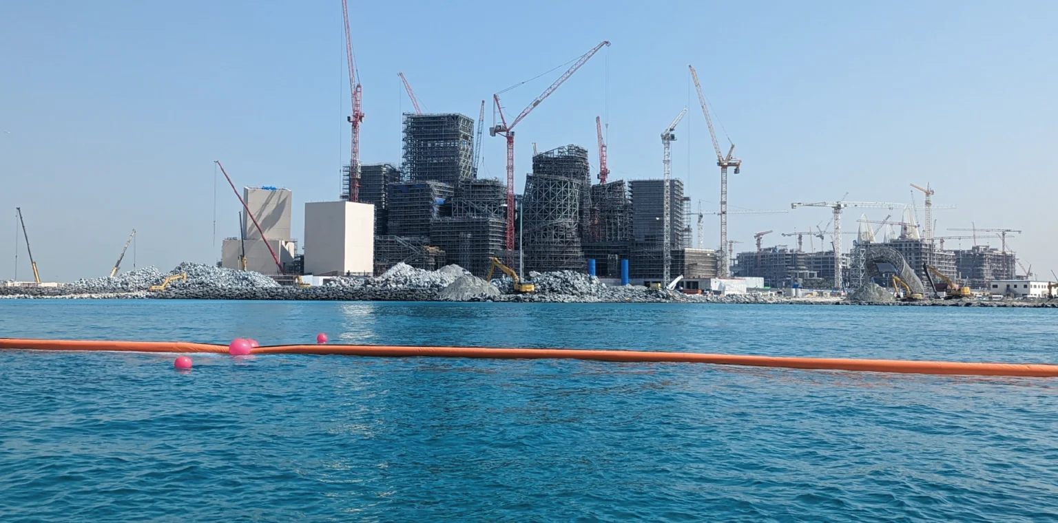
The Arabian Gulf hosts some of the world's most unique and thermally stressed marine environments — including coral reefs, seagrass meadows, mangrove systems, hawksbill turtle nesting sites, and dugong habitats. Coastal development, dredging, reclamation, and port expansion must be carefully managed to avoid irreversible ecological harm.
GCEEC's marine specialists bring extensive fieldwork experience across UAE waters — from Abu Dhabi's protected marine areas and Dubai's coastal zones to Fujairah's east coast coral reefs and the offshore Gulf of Oman — delivering credible, regulator-ready marine environmental reports.
Comprehensive Marine & Coastal Services
Science-led, regulator-approved marine environmental services covering the full project lifecycle — from pre-development baseline surveys through construction monitoring and post-project ecological assessment.
Marine Environmental Impact Assessments
Comprehensive Marine EIA studies for port, coastal, dredging, and offshore development projects in compliance with UAE and GCC authority requirements.
Includes
- Baseline marine ecological surveys
- Impact prediction & significance assessment
- Mitigation hierarchy & environmental controls
- Environmental Management Plan (EMP)
- Sedimentation & turbidity plume modelling
- EAD / MOCCAE / DM submission & approval
Coral Reef & Seagrass Surveys
Detailed ecological assessment of coral reef health, seagrass meadow extent, and associated marine biodiversity in UAE and Gulf waters.
Includes
- Coral cover & bleaching status assessment
- Coral genus & species identification
- Seagrass species composition & density
- Fish community & invertebrate surveys
- Photo-quadrat & manta tow methods
- Reef health index & trend monitoring
Hydrographic & Bathymetric Studies
Precision seabed mapping, water depth profiling, and current/wave analysis to support safe marine navigation, dredging, and coastal design.
Includes
- Multi-beam & single-beam echo sounding
- Side-scan sonar & sub-bottom profiling
- Tidal datum & water level analysis
- Current profiling (ADCP)
- Coastal topographic & LiDAR surveys
- Navigation chart preparation & GIS outputs
Aquaculture Development & Consultancy
Technical and environmental consultancy for offshore and coastal aquaculture projects — from site selection and carrying capacity to regulatory permitting.
Includes
- Site suitability & carrying capacity studies
- Water quality & oceanographic baseline
- Species selection & stocking density advice
- Environmental impact & waste dispersion modelling
- EAD / MOCCAE aquaculture licensing support
- Monitoring programmes for operational farms
Marine Water Quality Monitoring
Systematic monitoring of marine and coastal water quality parameters to assess pollution, support regulatory compliance, and detect ecological stress.
Includes
- Physicochemical parameters (DO, pH, salinity, turbidity)
- Nutrients, heavy metals & hydrocarbons
- Chlorophyll-a & phytoplankton analysis
- Sediment quality & benthic sampling
- Real-time buoy & continuous monitoring
- USEPA & UAE/GCC regulatory standard reporting
Coastal Engineering Support
Environmental advisory for shoreline protection, coastal erosion management, breakwater design review, and beach nourishment projects.
Includes
- Coastal erosion & accretion assessment
- Shoreline change & vulnerability mapping
- Environmental review of coastal structures
- Beach nourishment ecological impact studies
- Sea-level rise & climate change adaptation
- Reclamation & dredging spoil management
Protected Species & Habitat Surveys
Surveys targeting UAE and Gulf protected species including hawksbill turtles, dugongs, whale sharks, dolphins, and mangrove ecosystems.
Includes
- Marine turtle nesting beach surveys
- Dugong habitat & feeding ground mapping
- Dolphin & marine mammal acoustic surveys
- Whale shark & ray encounter monitoring
- Mangrove extent & condition assessment
- Mitigation plans for protected species
Silt Curtain & Turbidity Management
Design, deployment, and monitoring of silt curtain systems and dredge plume controls to protect sensitive marine habitats during construction works.
Includes
- Silt curtain design & specification
- Turbidity plume dispersion modelling
- Real-time turbidity monitoring (NTU)
- Trigger level & exceedance response protocols
- Weekly environmental compliance reports
- Post-dredge recovery monitoring surveys
Standards, Guidelines & Regulatory Frameworks
Survey Coverage by Water Column Zone
Full Water Column Survey Coverage
GCEEC operates across all marine survey zones — from sea surface water quality sampling to deep-water seabed profiling — using international survey standards and specialist field equipment.
SCUBA Ecological Surveys
Certified marine biologists conduct underwater transect and quadrat surveys to assess coral cover, seagrass density, and fish biodiversity in shallow coastal waters.
Vessel-Based Surveys
Hydrographic vessels equipped with multi-beam sonar, ADCP, and CTD probes for bathymetry, current profiling, and water column characterisation across larger survey areas.
Remote Sensing & GIS
Satellite imagery analysis, drone-based coastal mapping, and GIS spatial analysis to produce high-resolution habitat maps and change detection products.
Continuous Environmental Monitoring
Deployment of real-time water quality monitoring buoys and turbidity sensors at sensitive locations during dredging and construction to provide continuous regulatory compliance data.
6-Stage Marine Project Methodology
A structured approach covering the full project lifecycle — from pre-development baseline through post-project ecological recovery monitoring.
Marine Baseline Survey
Ecological, hydrographic, and water quality baseline characterisation of the project area.
Impact Assessment
Predict and evaluate environmental impacts from construction activities on marine habitats and species.
Authority Consultation
Engage with EAD, MOCCAE, DM, Trakhees, or EPDA for marine NOC and EIA approval.
Mitigation Design
Design environmental controls — silt curtains, working windows, exclusion zones, and best-practice protocols.
Construction Monitoring
Real-time turbidity monitoring, compliance inspections, and periodic ecological surveys during works.
Post-Project Assessment
Post-construction ecological recovery surveys to verify habitat recolonisation and mitigation effectiveness.
The Value of Expert Marine Environmental Services
Rigorous marine science protects both the environment and your project — securing approvals, reducing risk, and demonstrating genuine environmental stewardship.
Authority Approval Confidence
GCEEC's marine EIA reports are prepared to the technical standard expected by EAD, MOCCAE, Dubai Municipality, and Trakhees — minimising revision rounds and approval delays.
Ecosystem Protection
Science-led surveys and mitigation plans protect coral reefs, seagrass, mangroves, and protected species — reducing long-term ecological liability for project developers.
Reduced Project Risk
Early identification of sensitive receptors and environmental constraints prevents costly construction stoppages, authority enforcement actions, and reputational damage.
Credible Scientific Data
All surveys follow internationally recognised protocols (IHO, USEPA, ROPME) producing data that withstands independent technical review and court scrutiny.
Regulatory Relationship Management
Our established relationships with UAE marine authorities ensure smoother consultation processes and faster resolution of technical queries during the approval stage.
Biodiversity Net Gain
Where required, GCEEC designs coral transplantation, artificial reef, and marine habitat enhancement programs to achieve biodiversity net gain outcomes for project stakeholders.
Marine Services Across All Coastal Industries
GCEEC delivers marine and coastal environmental consultancy to a wide range of industries operating along the UAE and GCC coastline.
Port & Harbour Development
Marine EIA, hydrographic surveys, and dredge monitoring for port expansion, quay wall, and breakwater construction projects.
Coastal Real Estate
Ecological baseline and environmental impact studies for beachfront developments, waterfront communities, and island reclamation projects.
Oil, Gas & Offshore
Offshore environmental baseline, pipeline route surveys, drill cuttings monitoring, and subsea infrastructure environmental assessments.
Aquaculture & Fisheries
Site feasibility, carrying capacity studies, environmental licensing, and operational monitoring for fish and shrimp farm developments.
Tourism & Marina
Environmental impact assessments and coral survey programs for marina berth expansion, water sports facilities, and coastal resort developments.
Dredging & Land Reclamation
Pre-dredge ecological surveys, turbidity plume modelling, silt curtain management, and post-dredge recovery monitoring.
Utilities & Pipelines
Marine surveys and environmental management plans for submarine cable routes, water intake structures, and outfall discharge assessments.
Government & Municipalities
Marine protected area baseline surveys, coastal zone management plans, and shoreline monitoring programs for government clients.
Frequently Asked Questions
Answers to the most common questions about marine and coastal environmental services in the UAE and GCC.
When is a Marine EIA required in the UAE?
What marine habitats are protected in UAE waters?
What is a silt curtain and when is it required?
What does a hydrographic survey involve?
How long does a marine baseline survey take?
Can GCEEC assist with coral transplantation and habitat restoration?
Ready to Protect Your Marine Environment?
Whether you need a pre-development marine baseline survey, a marine EIA for authority submission, or ongoing construction monitoring — GCEEC's marine specialists are ready to deliver.